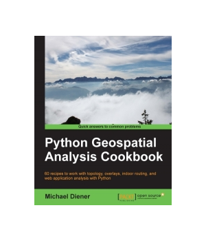
Python Geospatial Analysis Cookbook
Over 60 recipes to work with topology, overlays, indoor routing, and web application analysis with Python
| Price | $49.99 - $61.62
|
| Rating | |
| Author | Michael Diener |
| Publisher | Packt Publishing |
| Published | 2015 |
| Pages | 310 |
| Language | English |
| Format | Paper book / ebook (PDF) |
| ISBN-10 | 1783555076 |
| ISBN-13 | 9781783555079 |
Geospatial development links your data to places on the Earth's surface. Its analysis is used in almost every industry to answer location type questions. Combined with the power of the Python programming language, which is becoming the de facto spatial scripting choice for developers and analysts worldwide, this technology will help you to solve real-world spatial problems.
This book begins by tackling the installation of the necessary software dependencies and libraries needed to perform spatial analysis with Python. From there, the next logical step is to prepare our data for analysis; we will do this by building up our tool box to deal with data preparation, transformations, and projections. Now that our data is ready for analysis, we will tackle the most common analysis methods for vector and raster data. To check or validate our results, we will explore how to use topology checks to ensure top-quality results. This is followed with network routing analysis focused on constructing indoor routes within buildings, over different levels.
Finally, we put several recipes together in a GeoDjango web application that demonstrates a working indoor routing spatial analysis application. The round trip will provide you all the pieces you need to accomplish your own spatial analysis application to suit your requirements.

- Michael Diener
4 5 10
Similar Books
by Ivan Idris
Data analysis is a rapidly evolving field and Python is a multi-paradigm programming language suitable for object-oriented application development and functional design patterns. As Python offers a range of tools and libraries for all purposes, it has slowly evolved as the primary language for data science, including topics on: data analy...
Price: $34.99 | Publisher: Packt Publishing | Release: 2016
Learning R for Geospatial Analysis ![]()
![]()
![]()
![]()
![]()
by Michael Dorman
R is a simple, effective, and comprehensive programming language and environment that is gaining ever-increasing popularity among data analysts.This book provides you with the necessary skills to successfully carry out complete geospatial data analyses, from data import to presentation of results.Learning R for Geospatial Analysis is comp...
Price: $49.99 | Publisher: Packt Publishing | Release: 2014
by Bonny P McClain
Geospatial analysis is industry agnostic and a powerful tool for answering location questions. Combined with the power of SQL, developers and analysts worldwide rely on database integration to solve real-world spatial problems. This book introduces skills to help you detect and quantify patterns in datasets through data exploration, visua...
Price: $44.99 | Publisher: Packt Publishing | Release: 2023
Learning Geospatial Analysis with Python, 2nd Edition ![]()
![]()
![]()
![]()
![]()
by Joel Lawhead
Geospatial Analysis is used in almost every field you can think of from medicine, to defense, to farming. This book will guide you gently into this exciting and complex field. It walks you through the building blocks of geospatial analysis and how to apply them to influence decision making using the latest Python software.Learning Geospat...
Price: $44.99 | Publisher: Packt Publishing | Release: 2015
Python Geospatial Development, 2nd Edition ![]()
![]()
![]()
![]()
![]()
by Erik Westra
Geospatial development links your data to places on the Earth's surface. Writing geospatial programs involves tasks such as grouping data by location, storing and analyzing large amounts of spatial information, performing complex geospatial calculations, and drawing colorful interactive maps. In order to do this well, you'll nee...
Price: $29.99 | Publisher: Packt Publishing | Release: 2013
Mastering Geospatial Analysis with Python ![]()
![]()
![]()
![]()
![]()
by Paul Crickard, Eric van Rees, Silas Toms
Python comes with a host of open source libraries and tools that help you work on professional geoprocessing tasks without investing in expensive tools. This book will introduce Python developers, both new and experienced, to a variety of new code libraries that have been developed to perform geospatial analysis, statistical analysis, and...
Price: $49.99 | Publisher: Packt Publishing | Release: 2018
Clojure Data Analysis Cookbook ![]()
![]()
![]()
![]()
![]()
by Eric Rochester
Data is everywhere and it's increasingly important to be able to gain insights that we can act on. Using Clojure for data analysis and collection, this book will show you how to gain fresh insights and perspectives from your data with an essential collection of practical, structured recipes.The Clojure Data Analysis Cookbook - prese...
Price: $32.99 | Publisher: Packt Publishing | Release: 2013
Python Data Visualization Cookbook ![]()
![]()
![]()
![]()
![]()
by Igor Milovanovic
Today, data visualization is a hot topic as a direct result of the vast amount of data created every second. Transforming that data into information is a complex task for data visualization professionals, who, at the same time, try to understand the data and objectively transfer that understanding to others. This book is a set of practica...
Price: $23.99 | Publisher: Packt Publishing | Release: 2013

